Have you wondered where Syrian refugees have resettled in Ontario?
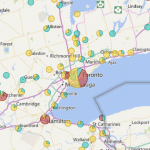
The federal government has released data on where Syrian refugees have resettled in Ontario. I have taken that data and made it much more interactive. I find the federal visualization static and not very informative or useful if you wanted to do analysis (for municipal planning for example). I have rebuilt the data to match the lower-tier municipal level structure in the province of Ontario.
The data is updated daily (link to the full-screen map).
Enjoy.
If you have any questions please leave me a comment.
EDIT: As of January 2, 2017, the Canadian federal government has stopped updating the data so you will not see any further updates to the live map.
Leave a Reply